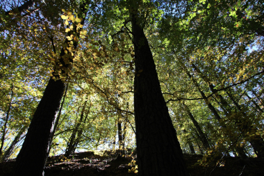
Monitoring of forest plots under management and free evolution in the Aigoual forest (observing task of the SO FORET)
Data from the 'Monitoring of forest plots under management and free evolution in the Aigoual forest' Observing Task, part of the Mediterranean forest ecosystem observatory (FORET) Observation Service of the Montpellier Research Observatory of Environment (OSU OREME, oreme.org).
Simple
- Date (Revision)
- 2025-08-21
- Identifier
-
643baed8-261a-4023-9f62-9d6b6d9c801e
- Status
- On going
- Maintenance and update frequency
- irregular Irregular
-
GEMET
-
AGROVOC
- Theme
-
-
FORET
-
Phenology
-
- Access constraints
- otherRestrictions Other restrictions
- Other constraints
-
Licence ouverte / Open Licence
- Use limitation
-
This work is licensed under the Licence ouverte / Open Licence ( https://www.etalab.gouv.fr/licence-ouverte-open-licence )
- Spatial representation type
- vector Vector
- Metadata language
- EnglishEnglish
- Character set
- utf8 UTF8
- Reference system identifier
-
EPSG
/4326
- Topology level
- geometryOnly Geometry only
- Geometric object type
- surface Surface
- Geometric object count
- 5
- Distribution format
-
-
CSV
()
-
- OnLine resource
-
See AIGLE information on OSU OREME website
(
WWW:LINK-1.0-http--link
)
- Hierarchy level
- dataset Dataset
Conformance result
- Date (Publication)
- 2010-12-08
- Explanation
-
See the referenced specification
- Pass
- Yes
Conformance result
- Date (Publication)
- 2008-12-03
- Explanation
-
See the referenced specification
- Pass
- Yes
- File identifier
- 643baed8-261a-4023-9f62-9d6b6d9c801e XML
- Metadata language
- EnglishEnglish
- Character set
- utf8 UTF8
- Parent identifier
-
Mediterranean forest ecosystem observatory (FORET) : Observation Service of the Montpellier Research Observatory of Environment (OSU OREME)
56fbc297-87f0-4a0d-b034-dabc2c25bd54
- Hierarchy level
- dataset Dataset
- Date stamp
- 2025-08-21T12:00:00
- Metadata standard name
-
ISO 19115:2003/19139
- Metadata standard version
-
1.0
- Dataset URI
-
OSU-OREME-AIGLE
Overviews
Spatial extent
Provided by