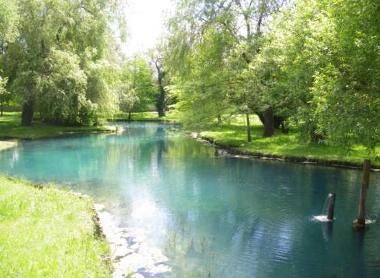
Time series of type hydrology-hydrogeology in L'Isle basin - KARSTS AQUITAINS observatory - KARST observatory network - OZCAR Critical Zone network Research Infrastructure
Data of type hydrology-hydrogeology measured on L'Isle basin within the framework of the KARSTS AQUITAINS observatory, that is part of the KARST observatory network. The KARST observatory network aims to strengthen knowledge-sharing and to promote cross-disciplinary research on karst systems, in the framework of the OZCAR Critical Zone network Research Infrastructure.
Data consist in 1 time series on 1 station(s).
The measured parameters are: Discharge (m3/s).
Measurements start on 01-07-2005 and end on 14-02-2024
Simple
- Date (Revision)
- 2025-08-21
- Date (Creation)
- 2005-07-01
- Identifier
-
78015481-3754-4a01-a6ce-99f569f312c8
- Status
- On going
Institut de Mécanique et d'Ingénierie, Département Génie Civil et Environnemental
-Lastennet, Roland
Institut de Mécanique et d'Ingénierie, Département Génie Civil et Environnemental
-Peyraube, Nicolas
- Maintenance and update frequency
- irregular Irregular
-
GEMET
-
AGROVOC
- Theme
-
-
SNO KARST
-
- Access constraints
- otherRestrictions Other restrictions
- Other constraints
-
Licence ouverte / Open Licence
- Use limitation
-
These data were gathered within the framework of the KARSTS AQUITAINS observation site. KARSTS AQUITAINS observation site is part of the KARST observatory network (sokarst.org) initiated by INSU/CNRS, which aims to strengthen knowledge-sharing and to promote cross-disciplinary research on karst systems in the framework of the OZCAR Critical Zone network Research Infrastructure.
SNO KARST data policy imposes the following constraints:
(i) Formal acknowledgement of the dataset providers,
(ii) Opportunity to collaborate on the project using the dataset,
(iii) Opportunity to review the results based on the dataset,
(iv) Reprints of articles using the dataset must be provided to the data provider,
(v) The data provider is given and agrees to a statement of uses to which the dataset will be put.
Please contact the resource person of the observation site for the use of these data, preferably as part of research collaboration.
If the use of these data results in a publication, thank you to communicate us the DOI and to mention the following sentence in the acknowledgements:
"This work was performed within the framework of the KARSTS AQUITAINS observation site. KARSTS AQUITAINS observation site is part of the KARST observatory network (sokarst.org) initiated by INSU/CNRS, which aims to strengthen knowledge-sharing and to promote cross-disciplinary research on karst systems in the framework of the OZCAR Critical Zone network Research Infrastructure. "
- Use limitation
-
This work is licensed under the Licence ouverte / Open Licence ( https://www.etalab.gouv.fr/licence-ouverte-open-licence )
- Spatial representation type
- vector Vector
- Metadata language
- EnglishEnglish
- Character set
- utf8 UTF8
))
- Begin date
- 2005-07-01T00:00:00
- End date
- 2024-02-14T00:00:00
- Reference system identifier
-
EPSG
/4326
- Topology level
- geometryOnly Geometry only
- Geometric object type
- surface Surface
- Geometric object count
- 5
- Distribution format
-
-
CSV
()
-
- OnLine resource
-
Get associated data for https://doi.org/10.15148/fcf00f41-f22c-47c0-beb4-031255793259
(
WWW:LINK-1.0-http--link
)
- OnLine resource
-
See KARSTS AQUITAINS site information on DEIMS / LTER
(
WWW:LINK-1.0-http--link
)
- Hierarchy level
- dataset Dataset
Conformance result
- Date (Publication)
- 2010-12-08
- Explanation
-
See the referenced specification
- Pass
- Yes
Conformance result
- Date (Publication)
- 2008-12-03
- Explanation
-
See the referenced specification
- Pass
- Yes
- Statement
-
The measured parameters are: Discharge (m3/s).
- File identifier
- 78015481-3754-4a01-a6ce-99f569f312c8 XML
- Metadata language
- EnglishEnglish
- Character set
- utf8 UTF8
- Parent identifier
-
KARST observatory network (SNOKARST)
8dbdb4d7-161a-45e3-b3c3-51e6058f6e8a
- Hierarchy level
- dataset Dataset
- Date stamp
- 2025-08-21T12:00:00
- Metadata standard name
-
ISO 19115:2003/19139
- Metadata standard version
-
1.0
- Dataset URI
-
OSU-OREME-SNOKARST-LISLE-2-KARSTSA
Overviews
Spatial extent
Provided by