 OSU OREME catalogue
Keyword
Topography
Type of resources
Available actions
INSPIRE themes
Keywords
Contact for the resource
Provided by
Years
Formats
Representation types
Update frequencies
status
From
1
-
2
/
2
-
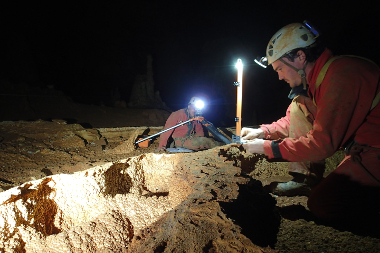
Data from the '3D surveys of karstic cavities' (KARST3D): The purpose of the Karst3D database is to help in the development of scientific studies requiring a better definition of the 3D structure of karst..
-

Data from the 'River incision, impact of extreme floods' (IRICE): Study of riverbed erosion in the Cévennes region. This observatory is part of the Montpellier Research Observatory of Environment (OSU OREME, oreme.org).